Road safety has been enhanced at multiple locations across Redlands Coast following the installation of new and improved flood warning infrastructure.
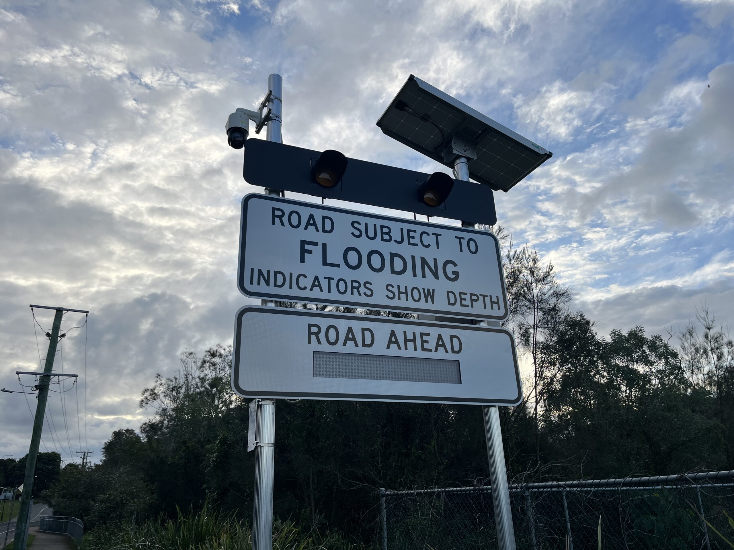
Upgraded LED road closure signage and flood cameras, three new rain gauges, and an upgraded water level sensor will provide additional information to first responders and the community during severe weather events.
The new assets delivered at Avalon Road, Sheldon; Moores Road, Redland Bay; the Giles Road closed landfill site, Redland Bay; Macleay Island Council Depot; and North Stradbroke Island Wastewater Treatment Plant have been funded by the Australian Government under its Emergency Response Fund.
You may also like these stories


The new water level sensor at Sovereign Waters Lake and the upgraded flood cameras and LED road closed signs at the Pitt and Nelson roads intersection, Wellington Point, were funded by Redland City Council.
Acting Mayor and Local Disaster Management Group Acting Chair Julie Talty said the new and improved assets would help to strengthen the flood warning infrastructure network within the city.
“These assets provide important information and real-time data to assist with situational awareness during severe weather events,” she said.
“Through the Flood Recovery and Resilience Package funded under the former Emergency Response Fund, the Australian Government provided $234,000 towards five of the new assets, with Council funding a further two.”
Cr Talty said Avalon Road, Moores Road, and the Pitt and Nelson Road intersection at Wellington Point had all received upgraded flood cameras and LED road closed signs.
“Road closure signage activates automatically, ensuring motorists and other road users are alerted to flood hazards and can avoid the area,” she said.
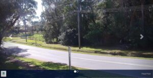
“Cameras installed at these locations also allow for the monitoring of conditions and will assist with timely emergency responses to flood-related incidents.
“This high-tech equipment provides remote access to vision of rising flood water levels, giving both emergency service providers and drivers up-to-date information to enhance safety.
“We saw the benefits of this infrastructure during the heavy rainfall event in May, with all three sites illuminating to warn motorists of road closures.
“Still images of the rising floodwaters were also available for the community to view on the Redlands Coast Disaster Dashboard.”
Cr Talty said the new electronic rain gauges had been installed at the Redland Bay Giles Road closed landfill site, Macleay Island Council Depot, and the North Stradbroke Island Wastewater Treatment Plant at Point Lookout.
“The new assets will ensure disaster management crews have better awareness of conditions across more areas of the city,” she said.
“We know the island gauges will make a big difference, as the rainfall totals in these areas can differ significantly to the mainland.”

Federal Minister for Emergency Management Kristy McBain said the Australian Government’s investment in Redland City’s flood warning infrastructure would improve the region’s preparedness for future floods.
“The Australian Government is committed to delivering resilience and risk reduction initiatives right across Queensland,” Minister McBain said.
“We know that upgraded early warning systems that provide better information are a major boost in flood preparedness across the community and saves lives.
“We’ll continue to invest in initiatives like this because we know how important preparedness is to the resilience of local communities.”
To access the Redlands Coast Disaster Dashboard, visit disaster.redland.qld.gov.au.