• Visit Redland City Council
15 °c
Redland Bay
18 ° Mon
18 ° Tue
Sunday, August 24 2025
Redlands Coast Today - News from Redland City Council
  • Community
    • Get the Facts
    • Environment
  • Planned Burns
    • Disaster Management
  • Business
  • Budget 2025 – 26
    • Budget 2024 – 25
    • Budget 2023 – 24
  • Archive
  • What’s On
  • NewslettersSubscribe
No Result
View All Result
  • Community
    • Get the Facts
    • Environment
  • Planned Burns
    • Disaster Management
  • Business
  • Budget 2025 – 26
    • Budget 2024 – 25
    • Budget 2023 – 24
  • Archive
  • What’s On
  • NewslettersSubscribe
No Result
View All Result
Redlands Coast Today - News from Redland City Council
No Result
View All Result

Planned burn: Russell Island – 2 to 6 September 2024

2 September 2024
Reading Time: 2 mins read
A A
Planned burn: Russell Island – 2 to 6 September 2024
Share on FacebookShare on TwitterShare on LinkedInEmail

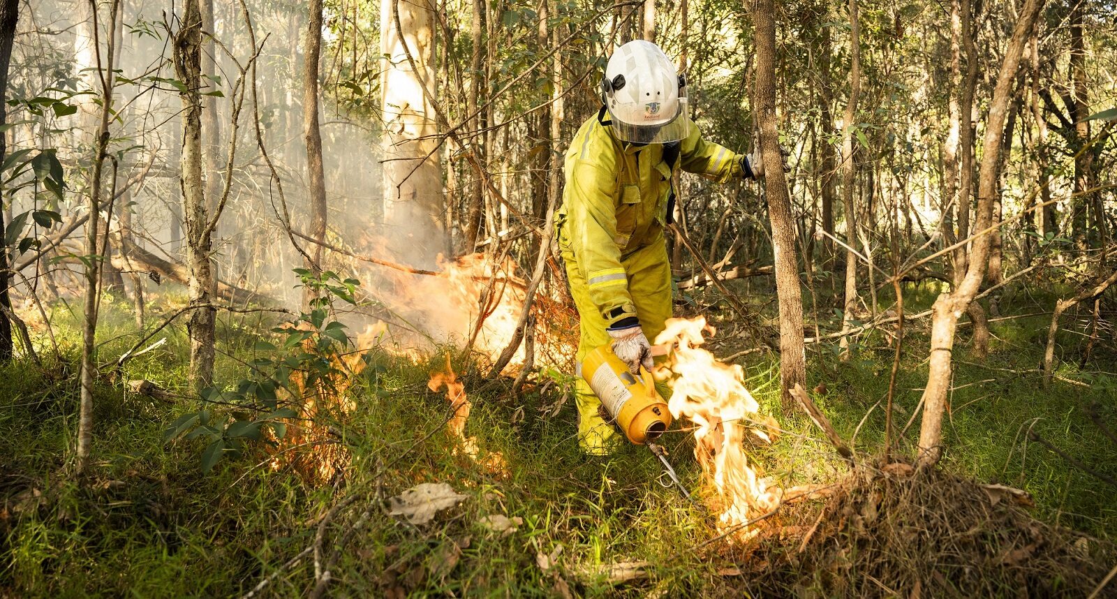
Redland City Council’s Parks and Conservation crews in conjunction with the Russell Island Rural Fire Service Queensland Fire Department will undertake multiple hazard reduction burns in sections of bushland on Russell Island between Monday 2 and Friday 6 September 2024, weather conditions permitting.

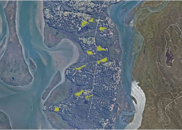
The location of the burn areas are highlighted in yellow on the map:

  • 172-216 High Street (Whistling Kite Wetland)
  • 17 Jupiter Street (Jupiter Street Bushland Refuge)
  • 93-129 Centre Road (Turtle Swamp Wetland)
  • 153-165 Centre Road (Turtle Swamp Wetland)
  • 12-30 Bilambil Drive (Turtle Swamp Wetland)
  • 14 Darwallah Avenue (Turtle Swamp Wetland)
  • 33 Grove Road (Water Mouse Wetland)
  • 2-24 Stradbroke Drive (Melomys Wetland)
  • 3-19 Coolabah Street (Coolabah Street Bushland Refuge)

You may also like these stories

Council supports 31 local projects through community grants

Applications open for capital infrastructure grants

18 August 2025
Japanese students learn about Redlands Coast

Japanese students learn about Redlands Coast

18 August 2025

The purpose of the burns is to reduce the volume of forest litter fuel, which will assist with hazard reduction – reducing the fire danger and providing conditions essential for native regeneration.

It is appreciated that this burn may cause some inconvenience, however all attempts will be made to limit any smoke hazards.

Traffic guidance schemes will be in place for each site, and traffic control and/or advisory signs will be place in locations where traffic may be impacted with smoke.

Motorists are advised to drive with caution and to conditions.

Council recommends that people close their windows and doors and those who have a respiratory condition keep their medications nearby.

To protect wildlife during a planned burn, Council:

  • Aims to carry out cooler, less intense and slower burns with lower flames
  • Excludes sensitive wildlife habitat from planned burn areas
  • Burns in a mosaic/patchy manner
  • Inspects sites for wildlife and clears around hollow-bearing trees and important habitat features prior to burns
  • Walks through the site during burn preparation activities (days leading up to the burn date) and also on the day of the burn
  • Tries to ensure that wildlife has safe movement corridors if they need to move out of the area temporarily.

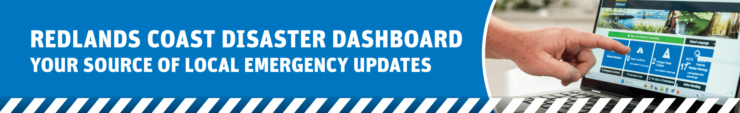
Residents can receive targeted alerts about planned burns on Council land, based on burn location and prevailing winds, by opting in for community alerts through Council’s emergency notification messaging service. To register, go Council’s Redlands Coast Disaster Dashboard at disaster.redland.qld.gov.au and follow the prompts under the Redlands Coast Alerts tab.

For more information about Council’s planned burn program, visit redland.qld.gov.au/PlannedBurns


Related Stories

Council

Local law change to support enforcement of shopping centre’s regulated parking

22 August 2025
It’s a fat-out NO. Don’t pour milk down the kitchen sink
Waste and recycling

It’s a fat-out NO. Don’t pour milk down the kitchen sink

19 August 2025
Laying down what they’re picking up – Council’s road surface revolution
Roads and transport

Laying down what they’re picking up – Council’s road surface revolution

19 August 2025
Second living shoreline trial set for shore, for sure
Environment

Second living shoreline trial set for shore, for sure

19 August 2025
Load More
Redlands Coast
Sunday, August 24, 2025
Partly Cloudy
15 ° c
94%
4mh
23 c 14 c
Mon
23 c 14 c
Tue
Redlands Coast Today

Redland City Council acknowledges the Quandamooka People, the Traditional Owners of the land, waters, winds and seas of Redlands Coast. We acknowledge the Elders, past and present, and extend that respect to other Aboriginal and Torres Strait Islander people here.

Connect with Redland City Council

  • Archive
  • Privacy and Legal
  • Right to Information
  • Contact Us

Except where noted, content on this site is licensed under Creative Commons.

Welcome Back!

Login to your account below

Forgotten Password?

Retrieve your password

Please enter your username or email address to reset your password.

Log In

Add New Playlist

No Result
View All Result
  • Community
    • Get the Facts
    • Environment
  • Planned Burns
    • Disaster Management
  • Business
  • Budget 2025 – 26
    • Budget 2024 – 25
    • Budget 2023 – 24
  • Archive
  • What’s On
  • Newsletters

Except where noted, content on this site is licensed under Creative Commons.