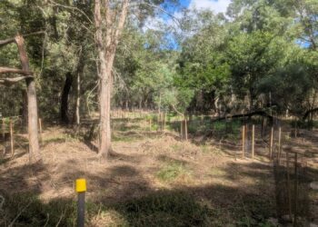
Redland City Council Parks and Conservation crews will undertake a planned burn within the Bayview Conservation Area today, Thursday 1 August 2024, from about 9am, weather conditions permitting.
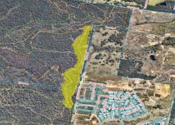
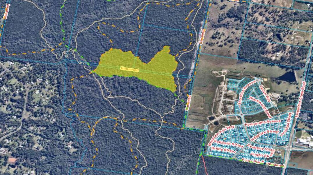
The location of the burn area is 243-271 Days Road, Redland Bay – highlighted in yellow on the map.

Update as at 9.40am on 25 July 2024
You may also like these stories

The planned burn that was scheduled for 25 July 2024 within the Bayview Conservation Area in Redland Bay has been cancelled and will be rescheduled at a later date.
Update as at 9.30am on 24 July 2024
Redland City Council’s Parks and Conservation crews will undertake a hazard reduction burn in a section of bushland within the Bayview Conservation Area on Thursday 25 July 2024, weather conditions permitting.
The location of the burn area is 243-271 Days Road, Redland Bay – highlighted in yellow on the map.
The purpose of the burn is to reduce the volume of forest litter fuel, which will assist with hazard reduction – reducing the fire danger and providing conditions essential for native regeneration.
It is appreciated that this burn may cause some inconvenience, however all attempts will be made to limit any smoke hazards.
Traffic management (control burn and smoke hazard advisory signs) will be in place in neighbouring streets that may be impacted by smoke.
Motorists are advised to drive with caution and to conditions.
Council recommends that people close their windows and doors and those who have a respiratory condition keep their medications nearby.
To protect wildlife during a planned burn, Council:
- Aims to carry out cooler, less intense and slower burns with lower flames
- Excludes sensitive wildlife habitat from planned burn areas
- Burns in a mosaic/patchy manner
- Inspects sites for wildlife and clears around hollow-bearing trees and important habitat features prior to burns
- Walks through the site during burn preparation activities (days leading up to the burn date) and also on the day of the burn
- Tries to ensure that wildlife has safe movement corridors if they need to move out of the area temporarily.
Residents can receive targeted alerts about planned burns on Council land, based on burn location and prevailing winds, by opting in for community alerts through Council’s emergency notification messaging service. To register, go Council’s Redlands Coast Disaster Dashboard at disaster.redland.qld.gov.au and follow the prompts under the Redlands Coast Alerts tab.
For more information about Council’s planned burn program, visit redland.qld.gov.au/PlannedBurns
Redland City Council provides a suite of services to 166,873 residents and more than 63,000 residential households across Redlands Coast. Our naturally wonderful city on Quandamooka Country is home to more than 335 kilometres of coastline, six island communities and 12 mainland suburbs. Council’s planned burns program is funded through the Environment and Coastal Management Levy.